
Maps
Flora Syria On Line
Flora Maps

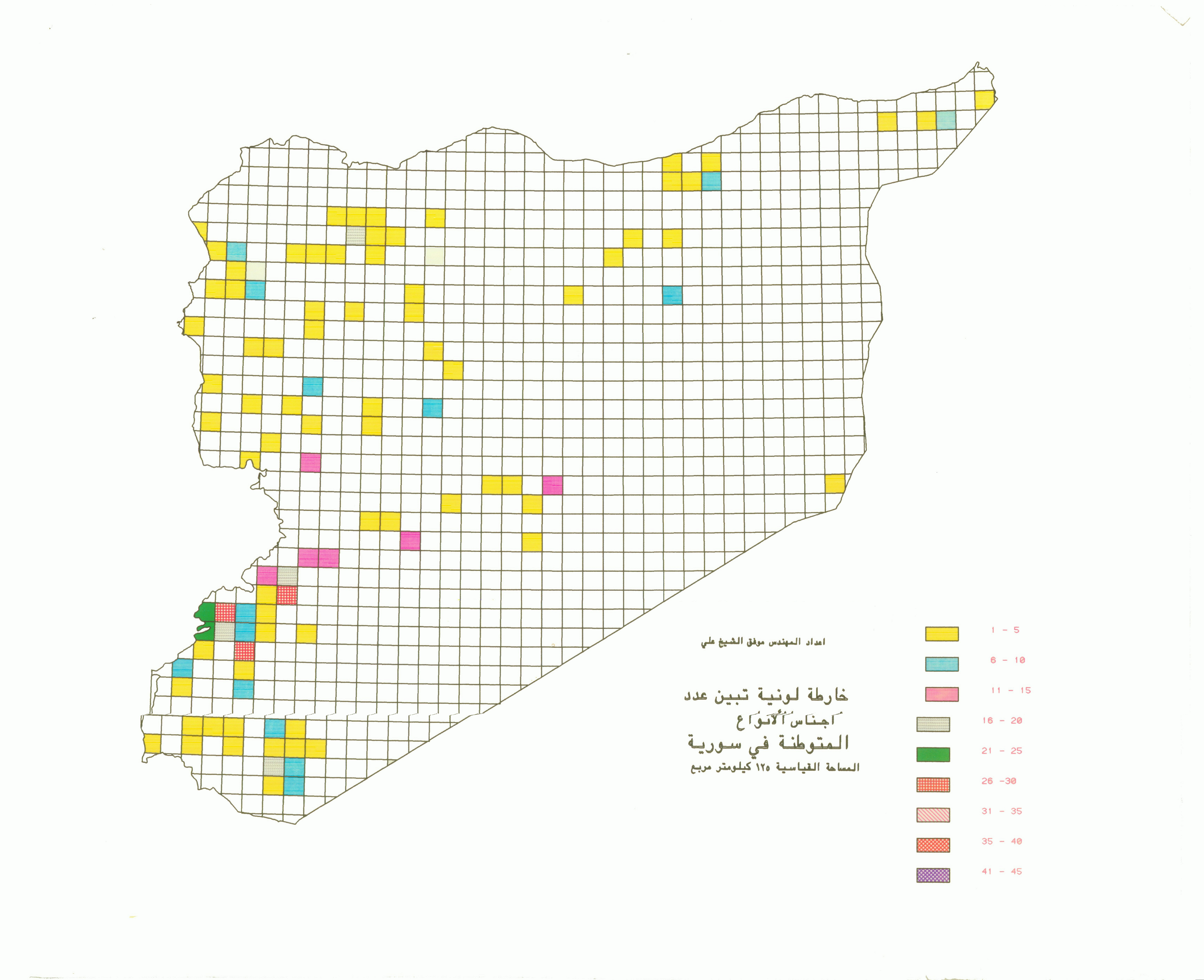
Number of Families of endemic species in 225 km surface area
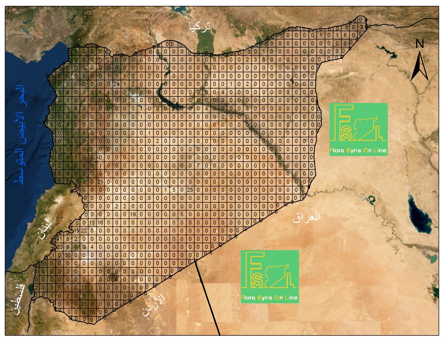
No. of endemic species in 225 km surface area
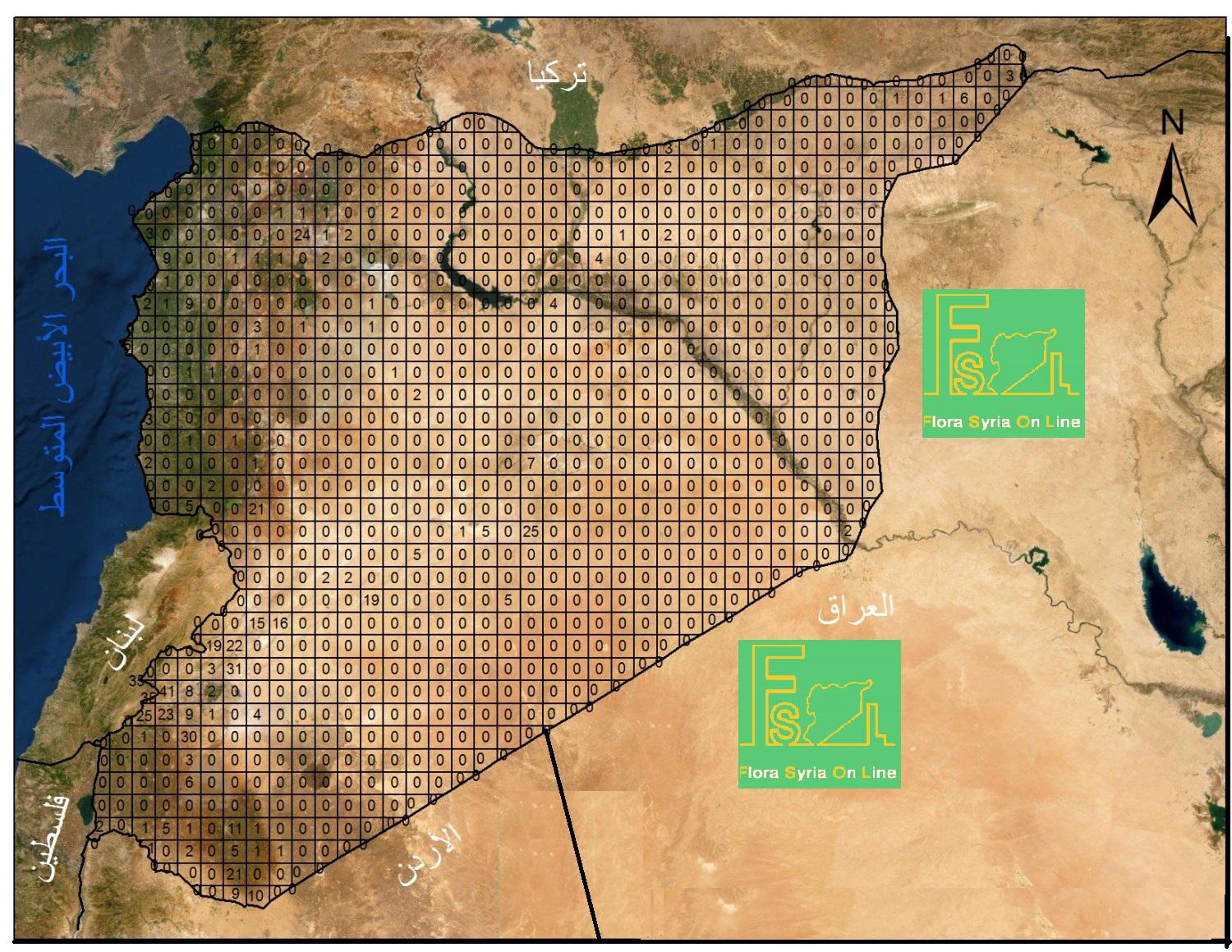
No. Genera of Endemic species in 225 km surface area
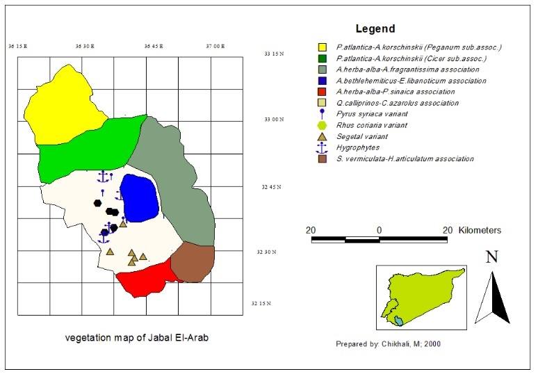
A map shows the vegetation cover of Jabal El-Arab
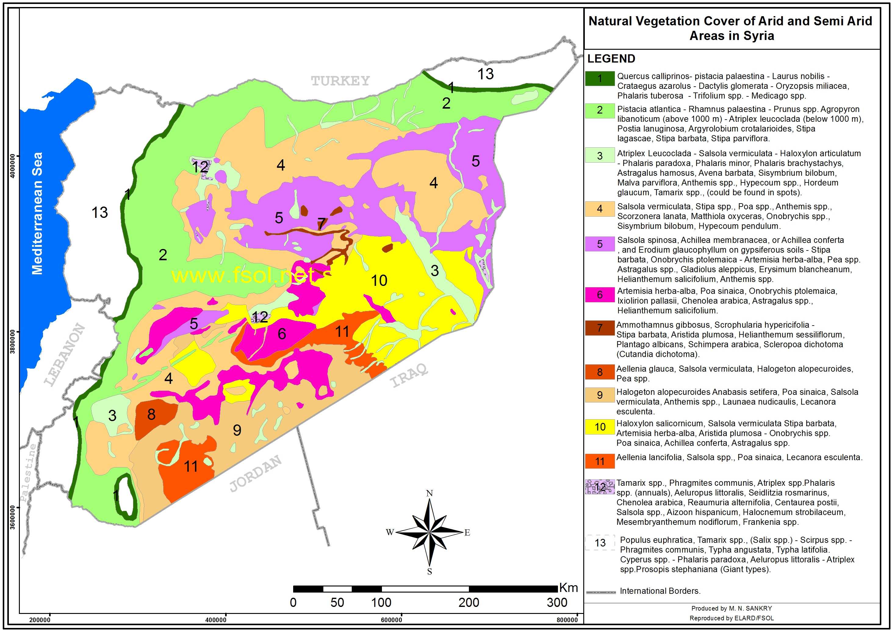
Natural Vegetation of large plants associations in dry and semi dry areas of Syria
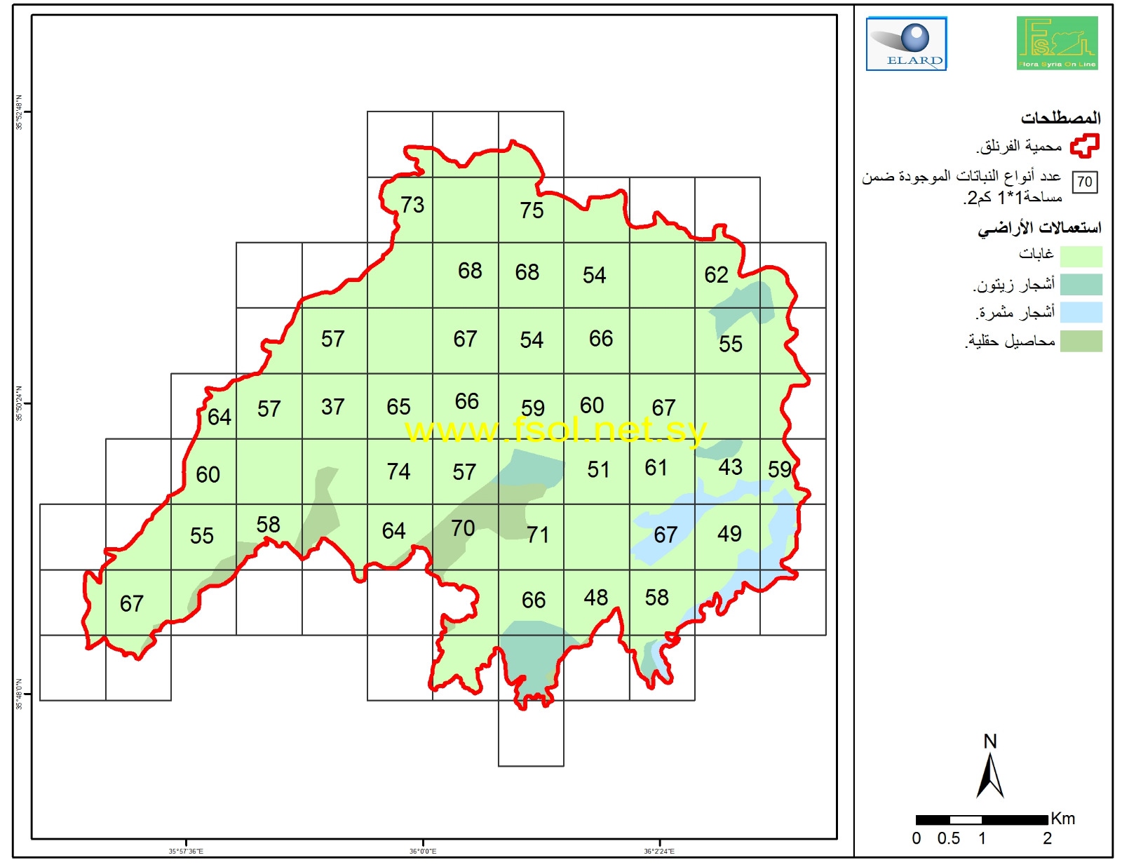
Recorded species in square of 1*1 km in Fronluq protected area.
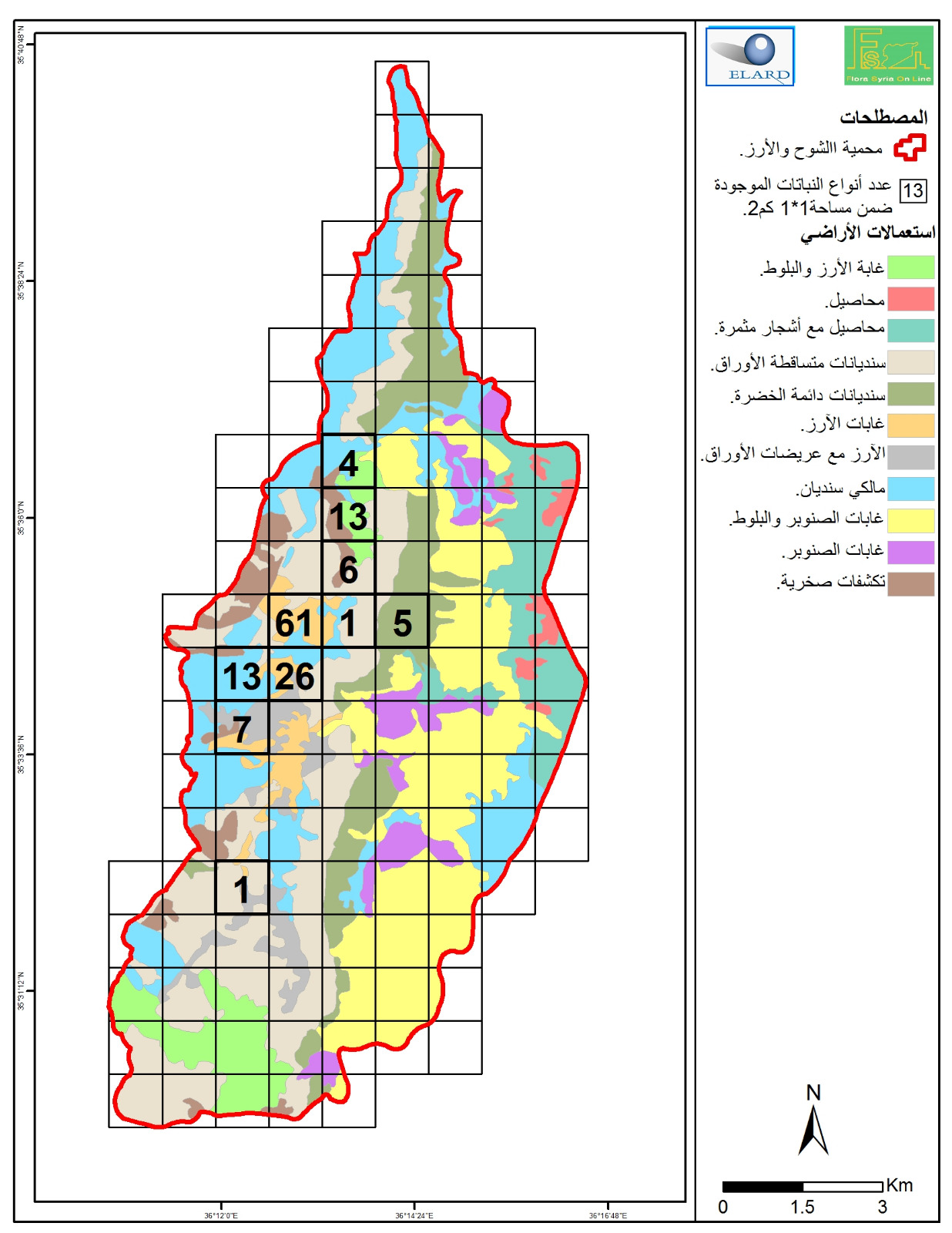
Species distribution map of Cedar and Fir protected area according to available coordinates.
نعمل من خلال تحديد التوزع الجغرافي للأنواع النباتية تطوير خريطة تقسيمات حيوية جغرافية جديدة في سورية